Attleborough railway station - view across Station Road
Introduction
The photograph on this page of Attleborough railway station - view across Station Road by Evelyn Simak as part of the Geograph project.
The Geograph project started in 2005 with the aim of publishing, organising and preserving representative images for every square kilometre of Great Britain, Ireland and the Isle of Man.

There are currently over 7.5m images from over 14,400 individuals and you can help contribute to the project by visiting https://www.geograph.org.uk
Attleborough railway station - view across Station Road
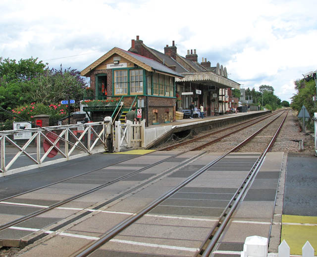
Image: © Evelyn Simak Taken: 20 Jul 2009
Attleborough > http://www.geograph.org.uk/photo/1408035 started out as a station of the Norfolk Railway and was later run by the Great Eastern Railway, before becoming part of the London and North Eastern Railway in 1923. As part of the 'Rural Stations Restaffing Initiative' a new Ticket Office opened in 2008, and presently the station is served by local services operated by East Midlands Trains and the Breckland Line, running from Norwich to Ely, Cambridge and Peterborough. The old signal box > http://www.geograph.org.uk/photo/1408045 is still in place and staffed, and the crossing gates > http://www.geograph.org.uk/photo/1407986 on Station Road (B 1077) have to be manually closed and opened by the signalman
Images are licensed for reuse under creativecommons.org/licenses/by-sa/2.0
Image Location
Latitude
52.515034
Longitude
1.02331