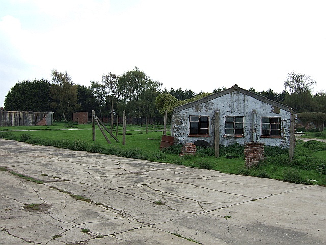
Marsworth Airfield (6) - Small unit
Introduction
The photograph on this page of Marsworth Airfield (6) - Small unit by Rob Farrow as part of the Geograph project.
The Geograph project started in 2005 with the aim of publishing, organising and preserving representative images for every square kilometre of Great Britain, Ireland and the Isle of Man.
There are currently over 7.5m images from over 14,400 individuals and you can help contribute to the project by visiting https://www.geograph.org.uk

Image: © Rob Farrow Taken: 7 May 2006
One of the numerous huts still standing on this fascinating old site, what its precise original function was I can only guess at, but it looks more like a meeting room or common room, rather than an accommodation unit or mess hall. Next picture in sequence Image] * Please Note: This former airfield is a private site and permission is required to gain access * General comments common to all photos in this sequence: This old airfield is known by several names, such as RAF Cheddington, RAF Marsworth, Cheddington Airfield etc. I am using Marsworth Airfield as the title throughout this series of photos as that is probably its commonest name nowadays. The airfield opened in March 1942 as RAF Cheddington, a satellite airfield to Wing. Wellington Bombers flew training missions out of here under the auspices of 26 Operational Training Unit. In September 1942 control of the airfield was passed to the US Army Airforce (USAAF). As a result the airfield became home to the B-24 Liberators of three squadrons (66th, 67th & 68th) of the Eighth Airforce 44th Bombardment Group. Quite soon however these squadrons were moved to Norfolk, and the RAFs 26th OTU returned. More training missions were flown from here during early 1943, and then in August of that year the US 8th Airforce returned, becoming Station 113. During 1944 several Bombardment squadrons flew special missions over Europe using mainly B24 Liberators, but also some B17 Flying Fortresses. These specials missions mostly involved leaflet drops, and document drops (such as fake ration books to disrupt the enemy's economy), but also involved early electronic warfare jamming RADAR and creating false signals etc. The airfield passed to the British Army once the War was over, and closed in 1952 since when it has mostly slowly decayed, though some of the buildings are used for small industrial purposes, and the northern end of the airfield nearer Cheddington is home to some newer industrial units.

