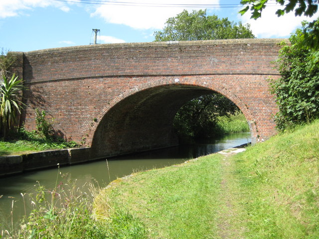
Kennet and Avon Canal: Horton Bridge
Introduction
The photograph on this page of Kennet and Avon Canal: Horton Bridge by Nigel Cox as part of the Geograph project.
The Geograph project started in 2005 with the aim of publishing, organising and preserving representative images for every square kilometre of Great Britain, Ireland and the Isle of Man.
There are currently over 7.5m images from over 14,400 individuals and you can help contribute to the project by visiting https://www.geograph.org.uk

Image: © Nigel Cox Taken: 12 Jul 2009
It's either an optical illusion or my camera but I could swear that the bridge is not symmetrical. Anyway this is Horton Bridge taking Horton Road over the canal. Update February 2011 I am indebted to a fellow Geographer, Maurice Pullin, for the following explanation "Not an optical illusion or a camera fault. As designed by John Rennie. The extra height over the towpath allowed horses to pass under without knocking their heads. If the bridge had been symmetrical it would have been much higher in the middle. All the original fixed bridges on the K&A were built this way, also bridges on the Lancaster Canal, another wide canal engineered by John Rennie."

