Derelict Pub, Neptune Street, Birkenhead
Introduction
The photograph on this page of Derelict Pub, Neptune Street, Birkenhead by El Pollock as part of the Geograph project.
The Geograph project started in 2005 with the aim of publishing, organising and preserving representative images for every square kilometre of Great Britain, Ireland and the Isle of Man.

There are currently over 7.5m images from over 14,400 individuals and you can help contribute to the project by visiting https://www.geograph.org.uk
Derelict Pub, Neptune Street, Birkenhead
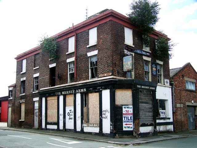
Image: © El Pollock Taken: 18 Jul 2009
This derelict wreck, that was the former Mersey Arms Public House, is situated on the corner of Neptune Street & Corporation Road. Now home to the hanging gardens of Birkenhead.
Images are licensed for reuse under creativecommons.org/licenses/by-sa/2.0
Image Location
Latitude
53.398984
Longitude
-3.026867