Co-op demolition, Belfast
Introduction
The photograph on this page of Co-op demolition, Belfast by Albert Bridge as part of the Geograph project.
The Geograph project started in 2005 with the aim of publishing, organising and preserving representative images for every square kilometre of Great Britain, Ireland and the Isle of Man.

There are currently over 7.5m images from over 14,400 individuals and you can help contribute to the project by visiting https://www.geograph.org.uk
Co-op demolition, Belfast
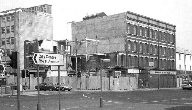
Image: © Albert Bridge Taken: 13 Jul 1983
Demolition of part of the Co-op, at the corner of Frederick Street and York Street (foreground). This allowed the corner of Frederick Street to be realigned in becoming part of the inner ring road (with the Dunbar Link). The wounded end of the Co was “bandaged” as seen in Image Frederick Street DHSS is on the left – see Image
Images are licensed for reuse under creativecommons.org/licenses/by-sa/2.0
Image Location
Latitude
54.605375
Longitude
-5.928116