Plaque on Wreights House, Faversham
Introduction
The photograph on this page of Plaque on Wreights House, Faversham by David Anstiss as part of the Geograph project.
The Geograph project started in 2005 with the aim of publishing, organising and preserving representative images for every square kilometre of Great Britain, Ireland and the Isle of Man.

There are currently over 7.5m images from over 14,400 individuals and you can help contribute to the project by visiting https://www.geograph.org.uk
Plaque on Wreights House, Faversham
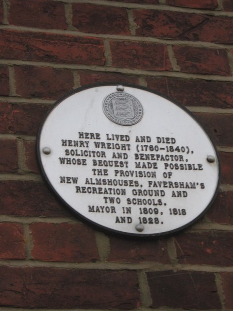
Image: © David Anstiss Taken: 2 Jul 2009
As seen from Ticklebelly Alley, from Preston Street to Alfreds Row. Plaque is also seen in Image One of 40 plaques around the town.
Images are licensed for reuse under creativecommons.org/licenses/by-sa/2.0
Image Location
Latitude
51.311282
Longitude
0.888793