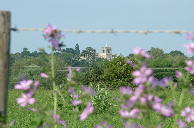
Shrubland Hall seen across fields
Introduction
The photograph on this page of Shrubland Hall seen across fields by John Goldsmith as part of the Geograph project.
The Geograph project started in 2005 with the aim of publishing, organising and preserving representative images for every square kilometre of Great Britain, Ireland and the Isle of Man.
There are currently over 7.5m images from over 14,400 individuals and you can help contribute to the project by visiting https://www.geograph.org.uk

Image: © John Goldsmith Taken: 29 Jun 2009
Despite its hilltop location, Shrubland Hall is surrounded by trees and not visible from public areas around the estate. However along the road north out of Great Blakenham there are several places like this where it can be seen. Maybe the hall has that tower so that the owners can also see out of their estate. In the space between the camera and the hall there is the busy dual carriageway A14 road and the main east/west rail line.

