Meggitt's Lane
Introduction
The photograph on this page of Meggitt's Lane by Mick Garratt as part of the Geograph project.
The Geograph project started in 2005 with the aim of publishing, organising and preserving representative images for every square kilometre of Great Britain, Ireland and the Isle of Man.

There are currently over 7.5m images from over 14,400 individuals and you can help contribute to the project by visiting https://www.geograph.org.uk
Meggitt's Lane
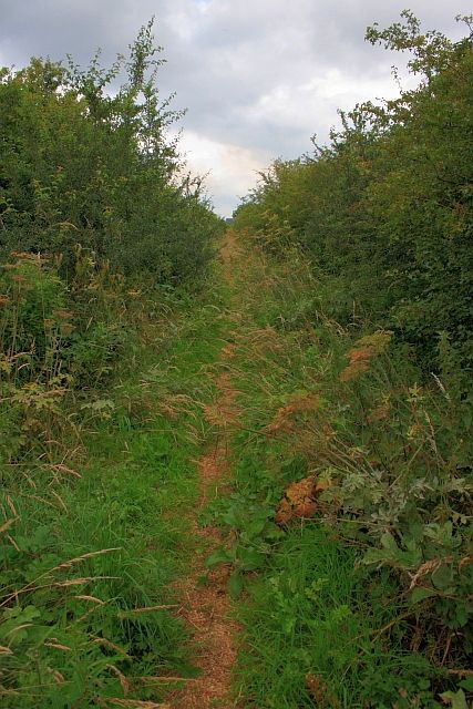
Image: © Mick Garratt Taken: 15 Jul 2009
This must be a very old Right of Way pre-dating the ICI complex built in the late 1940s. According to http://sites.google.com/site/waggonways/nz/55/nz5520 it is shown as a road on a 1857 map. It is still designated a Public Bridleway but largely overgrown and unused. This website: http://www.historyofdormanstown.0catch.com/dormanstown.htm.historypage%201.htm says that "there was a railway track from the Upleatham mines to the steelworks, until the ironstone ceased to be produced; it then became a rough, ancient pathway from the nearby village of Wilton, to the Fleet end of Dormanstown, known as Meggits Lane." This contradicts the information on the Waggon Ways website. This shows a tram way from the Upleatham Mines (Image) due north to join the Stockton and Darlington Railway at Ryehills Farm. The Waggon Ways map does indicate a tramway from Kirkleatham Mine (Image) but going parallel to Meggit's Lane (about half way across the field in this photo Image]). Furthermore Dormanstown was not built until the 1920s and the lane is not on a direct route from Wilton village (Image).
Images are licensed for reuse under creativecommons.org/licenses/by-sa/2.0
Image Location
Latitude
54.591793
Longitude
-1.09634