Mystery Cast Iron Marker
Introduction
The photograph on this page of Mystery Cast Iron Marker by BrianPritchard as part of the Geograph project.
The Geograph project started in 2005 with the aim of publishing, organising and preserving representative images for every square kilometre of Great Britain, Ireland and the Isle of Man.

There are currently over 7.5m images from over 14,400 individuals and you can help contribute to the project by visiting https://www.geograph.org.uk
Mystery Cast Iron Marker
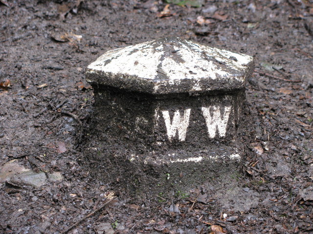
Image: © BrianPritchard Taken: 14 Jul 2009
These markers are located on the Clywedog Trail, between Minera and Bersham. They are standing about 9''high, 9'' across, and marked W W. They could be a boundary marker of the Williams-Wynn estate. Sir Watkin William Wynn held the Wynnstay estate near Ruabon. [information supplied by John Turner]
Images are licensed for reuse under creativecommons.org/licenses/by-sa/2.0
Image Location
Latitude
53.045152
Longitude
-3.06945