St Albans: Alma Road
Introduction
The photograph on this page of St Albans: Alma Road by Nigel Cox as part of the Geograph project.
The Geograph project started in 2005 with the aim of publishing, organising and preserving representative images for every square kilometre of Great Britain, Ireland and the Isle of Man.

There are currently over 7.5m images from over 14,400 individuals and you can help contribute to the project by visiting https://www.geograph.org.uk
St Albans: Alma Road
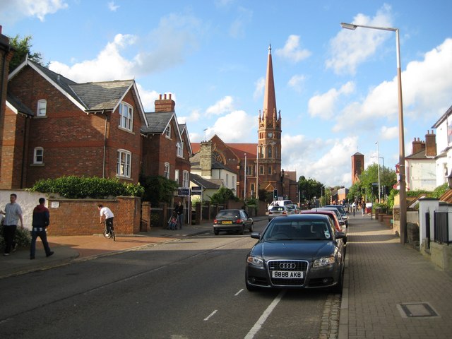
Image: © Nigel Cox Taken: 6 Jul 2009
The road is named after a battle during the Crimean War when an Anglo-French army under the command of Lord Raglan defeated a Russian army in the vicinity of the River Alma on 20 September 1854. The Victorians loved to commemorate these imperial victories and there are currently at least another 70 Alma Roads scattered through towns the length and breadth of the country. Image is prominent at the end of the road. and Image is also visible to the right.
Images are licensed for reuse under creativecommons.org/licenses/by-sa/2.0
Image Location
Latitude
51.750354
Longitude
-0.329411