Broadstone: postbox № BH18 172, Lower Blandford Road
Introduction
The photograph on this page of Broadstone: postbox № BH18 172, Lower Blandford Road by Chris Downer as part of the Geograph project.
The Geograph project started in 2005 with the aim of publishing, organising and preserving representative images for every square kilometre of Great Britain, Ireland and the Isle of Man.

There are currently over 7.5m images from over 14,400 individuals and you can help contribute to the project by visiting https://www.geograph.org.uk
Broadstone: postbox № BH18 172, Lower Blandford Road
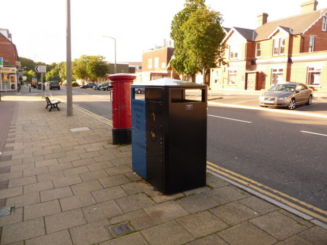
Image: © Chris Downer Taken: 12 Jul 2009
This flat section of Lower Blandford Road – forming Broadstone town centre – is known as the Broadway: see Image It is no surprise, then, that the postbox is a large one; it is of the Elizabeth II-reign variety and is emptied finally at 5:30pm on weekdays and at 12:30pm on Saturdays.
Images are licensed for reuse under creativecommons.org/licenses/by-sa/2.0
Image Location
Latitude
50.760443
Longitude
-1.994986