Wyck, Tisbury
Introduction
The photograph on this page of Wyck, Tisbury by Derek Harper as part of the Geograph project.
The Geograph project started in 2005 with the aim of publishing, organising and preserving representative images for every square kilometre of Great Britain, Ireland and the Isle of Man.

There are currently over 7.5m images from over 14,400 individuals and you can help contribute to the project by visiting https://www.geograph.org.uk
Wyck, Tisbury
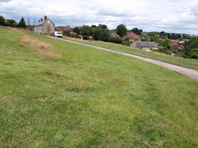
Image: © Derek Harper Taken: 9 Jul 2009
The longer lighter grass on the left is growing on a slope of one of the earthworks of the medieval village of Wyck, now a deserted field crossed by tracks and a footpath and overlooking the Nadder valley on the southwest edge of Tisbury. The short terrace on the left is on Monmouth Road. The houses to its right are on High View Close.
Images are licensed for reuse under creativecommons.org/licenses/by-sa/2.0
Image Location
Latitude
51.05761
Longitude
-2.08556