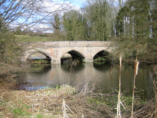
River Gade and the A4146 road bridge at Water End
Introduction
The photograph on this page of River Gade and the A4146 road bridge at Water End by Nigel Cox as part of the Geograph project.
The Geograph project started in 2005 with the aim of publishing, organising and preserving representative images for every square kilometre of Great Britain, Ireland and the Isle of Man.
There are currently over 7.5m images from over 14,400 individuals and you can help contribute to the project by visiting https://www.geograph.org.uk

Image: © Nigel Cox Taken: 19 Mar 2006
Viewed looking northwards and upstream. The bridge is a Grade II Listed Structure and the Historic England website describes it thus:- "Circa 1800 when road realigned, widened on E side (not the side in this photograph) 1976 by Herts County Council. Red brick in English-bond with stone dressings. A humped bridge in medieval style of 3 pointed arches each of 20ft span with 4 stone-capped cutwaters linked by a moulded string course. Deep-chamfered brick rib to soffit a little inside front arch. Chamfered stone dressing to plinths from which arches spring, linked by weir under bridge and marking water level on reconstructed upstream face. Moulded stone cappings to brick parapets splayed at ends and terminated by octagonal brick piers."

