Woodborough: Broad Street
Introduction
The photograph on this page of Woodborough: Broad Street by Nigel Cox as part of the Geograph project.
The Geograph project started in 2005 with the aim of publishing, organising and preserving representative images for every square kilometre of Great Britain, Ireland and the Isle of Man.

There are currently over 7.5m images from over 14,400 individuals and you can help contribute to the project by visiting https://www.geograph.org.uk
Woodborough: Broad Street
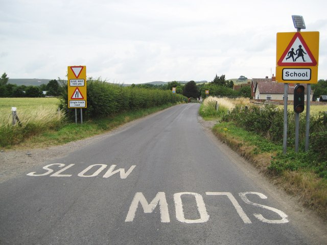
Image: © Nigel Cox Taken: 10 Jul 2009
A proliferation of road signs and instructions greet the motorist on entering Woodborough from the south, with a pair of 30 mph restriction signs a little further on. Note that the amber flashing school warning lights on the right appear to be powered by a solar panel. Just visible as a faint grey splodge on the distant hill between the trees in the hedge on the left is Image
Images are licensed for reuse under creativecommons.org/licenses/by-sa/2.0
Image Location
Latitude
51.335574
Longitude
-1.848366