Entrance fortifications, The Verne
Introduction
The photograph on this page of Entrance fortifications, The Verne by John Goldsmith as part of the Geograph project.
The Geograph project started in 2005 with the aim of publishing, organising and preserving representative images for every square kilometre of Great Britain, Ireland and the Isle of Man.

There are currently over 7.5m images from over 14,400 individuals and you can help contribute to the project by visiting https://www.geograph.org.uk
Entrance fortifications, The Verne
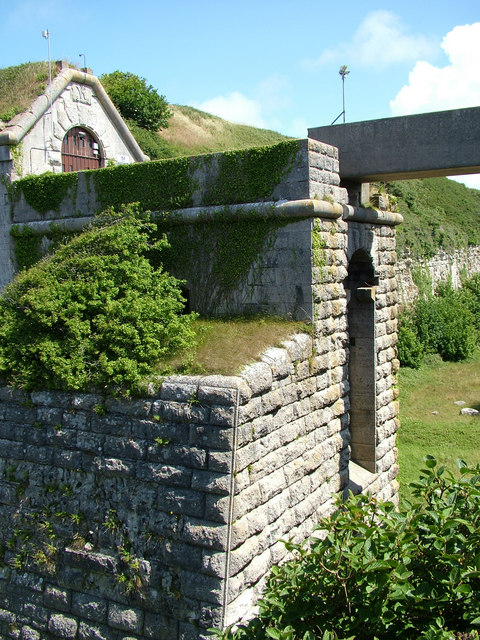
Image: © John Goldsmith Taken: 5 Jul 2009
The builders of The Verne Battery and Barracks (now prison) seemed to be seriously worried about land attack from the rear, and built this very deep moat, and then a long access tunnel after the main doors. I guess there was originally a removable bridge, and there are traces of previous engineering below the more recent concrete bridge.
Images are licensed for reuse under creativecommons.org/licenses/by-sa/2.0
Image Location
Latitude
50.559459
Longitude
-2.432791