Pollock Drive, Mourneview
Introduction
The photograph on this page of Pollock Drive, Mourneview by Dean Molyneaux as part of the Geograph project.
The Geograph project started in 2005 with the aim of publishing, organising and preserving representative images for every square kilometre of Great Britain, Ireland and the Isle of Man.

There are currently over 7.5m images from over 14,400 individuals and you can help contribute to the project by visiting https://www.geograph.org.uk
Pollock Drive, Mourneview
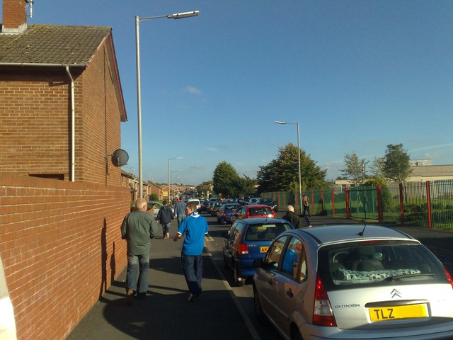
Image: © Dean Molyneaux Taken: 20 Sep 2008
This is view from the western end of Pollock Drive, the main east-west thoroughfare in Lurgan's Mourneview Estate. The crowd can be explained by a football match at nearby Mourneview Park - home of Glenavon F.C. The building to the right is the Dickson Primary School.
Images are licensed for reuse under creativecommons.org/licenses/by-sa/2.0
Image Location
Latitude
54.453043
Longitude
-6.336127