Countryside around Burrow from the air
Introduction
The photograph on this page of Countryside around Burrow from the air by Derek Harper as part of the Geograph project.
The Geograph project started in 2005 with the aim of publishing, organising and preserving representative images for every square kilometre of Great Britain, Ireland and the Isle of Man.

There are currently over 7.5m images from over 14,400 individuals and you can help contribute to the project by visiting https://www.geograph.org.uk
Countryside around Burrow from the air
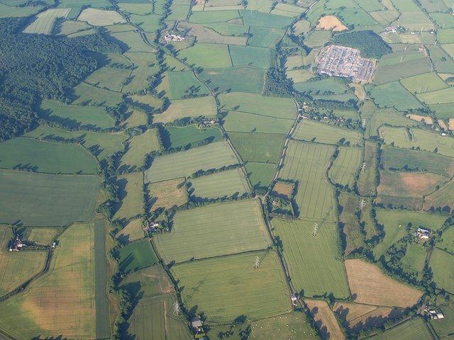
Image: © Derek Harper Taken: 1 Jul 2009
The River Clyst crosses the left half of the image towards the camera; the further part of this course, running below Ashclyst Forest, is in Image Until it reaches a level with Chillacombe Farm (lower left), it is in Image The fork in the road is at Forches Head. Above right is Exeter electricity substation - see Image Seen from a hot air balloon.
Images are licensed for reuse under creativecommons.org/licenses/by-sa/2.0
Image Location
Latitude
50.770219
Longitude
-3.420897