Dog Village and Broadclyst from the air
Introduction
The photograph on this page of Dog Village and Broadclyst from the air by Derek Harper as part of the Geograph project.
The Geograph project started in 2005 with the aim of publishing, organising and preserving representative images for every square kilometre of Great Britain, Ireland and the Isle of Man.

There are currently over 7.5m images from over 14,400 individuals and you can help contribute to the project by visiting https://www.geograph.org.uk
Dog Village and Broadclyst from the air
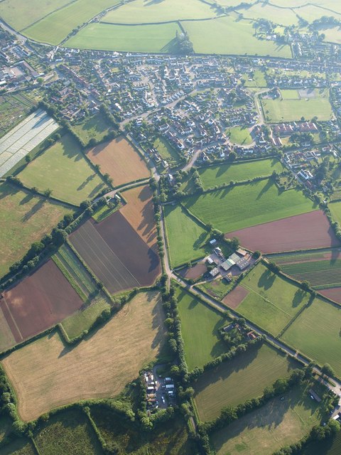
Image: © Derek Harper Taken: 1 Jul 2009
Dog Village is to the left, Broadclyst to the right (in Image); the two are fused together by the estates in the middle. In the foreground, lanes approaching from Rockbeare and Whimple meet at a fork. Seen from a hot air balloon.
Images are licensed for reuse under creativecommons.org/licenses/by-sa/2.0
Image Location
Latitude
50.761938
Longitude
-3.436244