Gas holder 'tank', Higher Woodhill Mill site
Introduction
The photograph on this page of Gas holder 'tank', Higher Woodhill Mill site by Chris Allen as part of the Geograph project.
The Geograph project started in 2005 with the aim of publishing, organising and preserving representative images for every square kilometre of Great Britain, Ireland and the Isle of Man.

There are currently over 7.5m images from over 14,400 individuals and you can help contribute to the project by visiting https://www.geograph.org.uk
Gas holder 'tank', Higher Woodhill Mill site
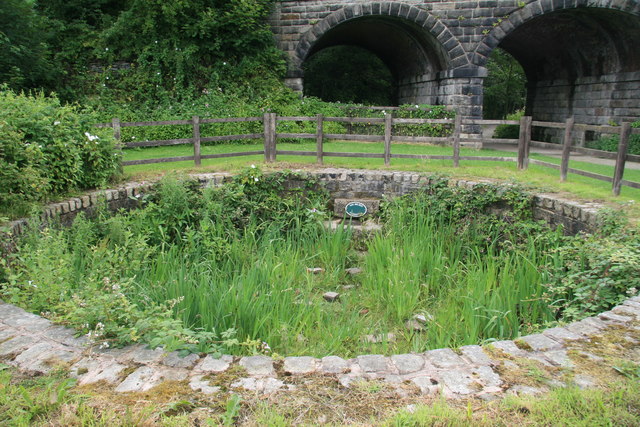
Image: © Chris Allen Taken: 4 Jul 2009
This would have been filled with water to provide the water seal on the gas holder that was associated with this mill. An important survivor. This is all in the Burrs Country Park but to date the Geograph photographers have concentrated on the Burrs Mill site at the other end of the park.
Images are licensed for reuse under creativecommons.org/licenses/by-sa/2.0
Image Location
Latitude
53.608496
Longitude
-2.30133