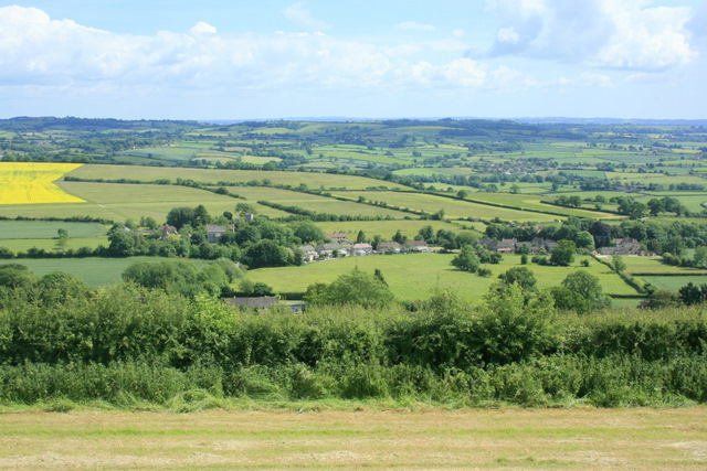
2009 : Norton Malreward from Maes Knoll
Introduction
The photograph on this page of 2009 : Norton Malreward from Maes Knoll by Maurice Pullin as part of the Geograph project.
The Geograph project started in 2005 with the aim of publishing, organising and preserving representative images for every square kilometre of Great Britain, Ireland and the Isle of Man.
There are currently over 7.5m images from over 14,400 individuals and you can help contribute to the project by visiting https://www.geograph.org.uk

Image: © Maurice Pullin Taken: 16 Jun 2009
Turning right from Image and facing almost due south, Norton Malreward appears, its parish church can be seen among the trees. An interesting story is told in: http://www.themodernantiquarian.com/post/39162/maes_knoll.html "This [Maes Knoll] is where Hautville's Quoit was thrown from, by Sir John Haut(e)ville (you can read more about this on the Hautville's Quoit page). He was just rehearsing for a throwing match with the Devil, which he ended up winning by throwing a rock from Shute Shelve to Compton Bishop (about a mile and a half) - the Devil threw 3 furlongs shorter. (From Grinsell's folklore book I think.) Sir John is apparently bured [sic] in Chew Magna church, where there's an oak effigy of him. This gentleman was remarkable for prodigious strength, as the Irish oak is probably intended to denote. Vulgar tradition informs us, that Edward the First having requested Sir John to shew him a specimen of his abilities, the knight undertook to convey three of the stoutest men in England to the top of Norton Tower [Norton Malreward is at the foot of Maes Knoll], situated in a neighbouring parish. Accordingly, taking one under each arm, and a third in his teeth, he proceeded on his task. The two in his arms, making some resistance, were squeezed to death, but the other was carried up without sustaining the smallest injury"

