Dundarg
Introduction
The photograph on this page of Dundarg by Anne Burgess as part of the Geograph project.
The Geograph project started in 2005 with the aim of publishing, organising and preserving representative images for every square kilometre of Great Britain, Ireland and the Isle of Man.

There are currently over 7.5m images from over 14,400 individuals and you can help contribute to the project by visiting https://www.geograph.org.uk
Dundarg
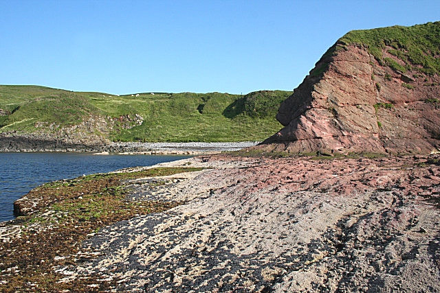
Image: © Anne Burgess Taken: 2 Jul 2009
The headland on the right here is the tip of the promontory on which the remains Dundarg Castle stand. The dip of the red sandstone beds can be clearly seen in the cliff face.
Images are licensed for reuse under creativecommons.org/licenses/by-sa/2.0
Image Location
Latitude
57.674203
Longitude
-2.177196