Baile a' Mhanaich from the air
Introduction
The photograph on this page of Baile a' Mhanaich from the air by Barbara Carr as part of the Geograph project.
The Geograph project started in 2005 with the aim of publishing, organising and preserving representative images for every square kilometre of Great Britain, Ireland and the Isle of Man.

There are currently over 7.5m images from over 14,400 individuals and you can help contribute to the project by visiting https://www.geograph.org.uk
Baile a' Mhanaich from the air
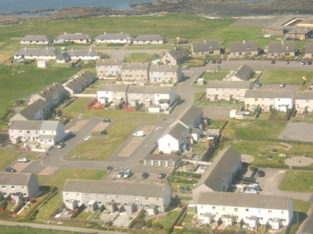
Image: © Barbara Carr Taken: 8 Jun 2009
Coming in to land at Benbecula Airport, on the 14.55 flight from Barra, over the housing-complex built for the armed forces at Balivanich - the school is at the top right of the picture.
Images are licensed for reuse under creativecommons.org/licenses/by-sa/2.0
Image Location
Latitude
57.472325
Longitude
-7.394163