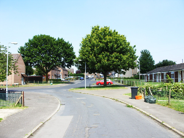
Cheddar Road, Moredon, Swindon
Introduction
The photograph on this page of Cheddar Road, Moredon, Swindon by Brian Robert Marshall as part of the Geograph project.
The Geograph project started in 2005 with the aim of publishing, organising and preserving representative images for every square kilometre of Great Britain, Ireland and the Isle of Man.
There are currently over 7.5m images from over 14,400 individuals and you can help contribute to the project by visiting https://www.geograph.org.uk

Image: © Brian Robert Marshall Taken: 2 Jul 2009
This view is in the heart of Moredon, a municipal housing estate built in the 1950s. Cheddar Road leads away from the viewpoint to its junction with Barton Road on the left. The houses on the left are of the 'Cornish' design, one of several non-traditional building systems developed in the immediate post-war years to enable as many houses as possible to be built by local authorities in the shortest time. The design principles typically involved the use of reinforced concrete and the generic term 'PRC' for pre-cast reinforced concrete was coined to describe system-built housing. Unfortunately, the use of this material led to structural problems developing in the life of the properties and they had to be comprehensively rebuilt to enable their continued existence. The bungalows on the right are of more traditional design and construction and were built to accommodated retired people.

