Creag Ghoraidh, looking over the sands to Gualan
Introduction
The photograph on this page of Creag Ghoraidh, looking over the sands to Gualan by Barbara Carr as part of the Geograph project.
The Geograph project started in 2005 with the aim of publishing, organising and preserving representative images for every square kilometre of Great Britain, Ireland and the Isle of Man.

There are currently over 7.5m images from over 14,400 individuals and you can help contribute to the project by visiting https://www.geograph.org.uk
Creag Ghoraidh, looking over the sands to Gualan
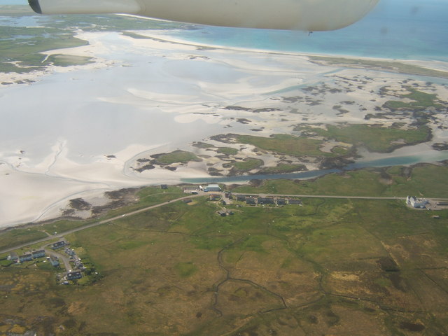
Image: © Barbara Carr Taken: 8 Jun 2009
While visiting Loch Druidibeg Nature Reserve Image], bedecked with camera and maps, I was approached by two brothers asking about local footpaths. It turned out that they were staying with their cousin, here at Creag Ghoraidh - they were natives of South Uist, but had left in 1955 for the city-life of Dundee. It says much of the changes that have taken place in the last half-century, that they felt it necessary to ask a visiting mainlander who just happened to have a map, about current footpath-access in their homeland. (They told me lots of stuff about the machair, and catching rabbits, and what life was really like in a black-house - including having no 'pocket money', which became a new joy for them when they hit Dundee!!)
Images are licensed for reuse under creativecommons.org/licenses/by-sa/2.0
Image Location
Latitude
57.410933
Longitude
-7.333415