Carnoustie golf course with industrial 'backdrop'
Introduction
The photograph on this page of Carnoustie golf course with industrial 'backdrop' by Val Vannet as part of the Geograph project.
The Geograph project started in 2005 with the aim of publishing, organising and preserving representative images for every square kilometre of Great Britain, Ireland and the Isle of Man.

There are currently over 7.5m images from over 14,400 individuals and you can help contribute to the project by visiting https://www.geograph.org.uk
Carnoustie golf course with industrial 'backdrop'
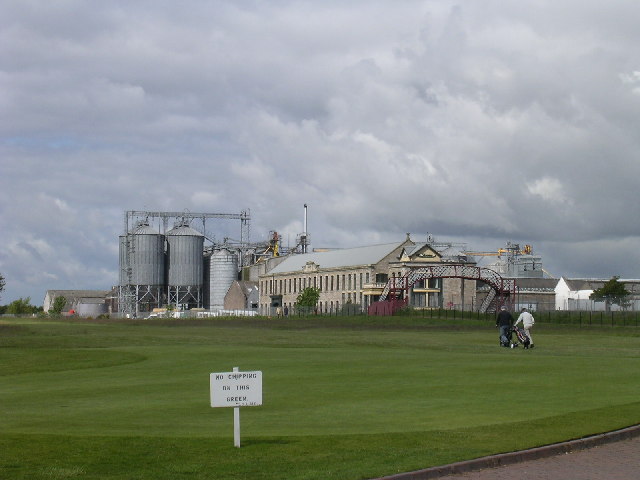
Image: © Val Vannet Taken: 30 May 2005
Landward of the golf course is the main east coast railway line and the Carnoustie maltings (closed in 2004) with its distinctive silos and the Panmure Works which is a former textile factory. It now operates as the HQ for a local supermarket company.
Images are licensed for reuse under creativecommons.org/licenses/by-sa/2.0
Image Location


Leaflet Map data © OpenStreetMap
Latitude
56.500459
Longitude
-2.724467