#3 The Haven
Introduction
The photograph on this page of #3 The Haven by Glyn Baker as part of the Geograph project.
The Geograph project started in 2005 with the aim of publishing, organising and preserving representative images for every square kilometre of Great Britain, Ireland and the Isle of Man.

There are currently over 7.5m images from over 14,400 individuals and you can help contribute to the project by visiting https://www.geograph.org.uk
#3 The Haven
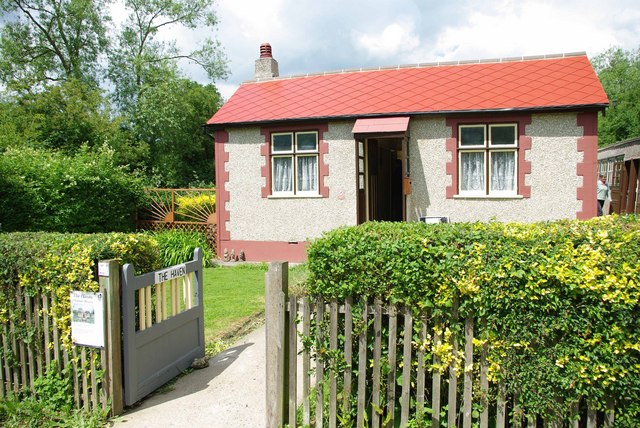
Image: © Glyn Baker Taken: 7 Jun 2009
The Haven is the last survivor of the Dunton Plotland dwellings that were built between the two world wars. Plots of land were sold cheaply to families mainly from East London for holiday homes. The deeds did not permit occupancy for a full twelve months of the year. This was ignored during WW2, after the war the council decided that it would cost far too much to bring the infrastructure up to modern standards so people were moved into the new town of Basildon. The last few houses being compulsorily purchased. The area was designated as a recreational area. To find out more see http://www.basildon.com/history/dunton/plotland.html 30 years ago the area was handed to the Essex Wildlife Trust see http://www.essexwt.org.uk/visitor_centres__nature_reserves/langdon/ The haven is now preserved as it was in the 1940's see Image To continue on a virtual tour based the Plotlands Walk (copies available currently for 75p from the visitor centre ) go to Image
Images are licensed for reuse under creativecommons.org/licenses/by-sa/2.0
Image Location
Latitude
51.561517
Longitude
0.397017