Town End Street
Introduction
The photograph on this page of Town End Street by Colin Smith as part of the Geograph project.
The Geograph project started in 2005 with the aim of publishing, organising and preserving representative images for every square kilometre of Great Britain, Ireland and the Isle of Man.

There are currently over 7.5m images from over 14,400 individuals and you can help contribute to the project by visiting https://www.geograph.org.uk
Town End Street
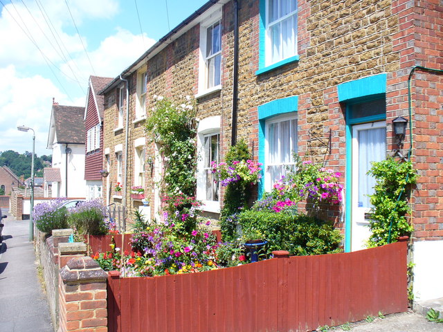
Image: © Colin Smith Taken: 27 Jun 2009
Victorian terraced housing with colourful garden and facings in central Godalming. The street is now cut off from the centre of the town by the ring road, Flambard Way. Flambard was a local Norman landowner.
Images are licensed for reuse under creativecommons.org/licenses/by-sa/2.0
Image Location
Latitude
51.183372
Longitude
-0.610259