Black House, An Leth Meadhanach
Introduction
The photograph on this page of Black House, An Leth Meadhanach by Barbara Carr as part of the Geograph project.
The Geograph project started in 2005 with the aim of publishing, organising and preserving representative images for every square kilometre of Great Britain, Ireland and the Isle of Man.

There are currently over 7.5m images from over 14,400 individuals and you can help contribute to the project by visiting https://www.geograph.org.uk
Black House, An Leth Meadhanach
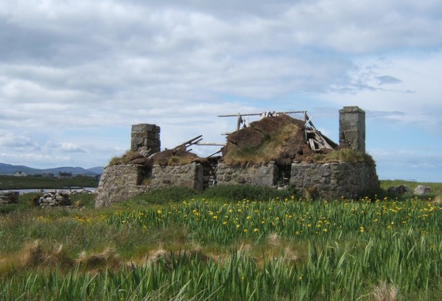
Image: © Barbara Carr Taken: 10 Jun 2009
In a field of flag iris, this ruinous black house shows how the height of the roof was level with the tops of the pot-less chimneys, and how the heather-thatch became firmly knitted-together as natural grasses seeded themselves and rooted and grew throughout the roofing material.
Images are licensed for reuse under creativecommons.org/licenses/by-sa/2.0
Image Location
Latitude
57.12881
Longitude
-7.377562