Caldwall Bridge, Staffs.& Worcs. Canal
Introduction
The photograph on this page of Caldwall Bridge, Staffs.& Worcs. Canal by Martyn B as part of the Geograph project.
The Geograph project started in 2005 with the aim of publishing, organising and preserving representative images for every square kilometre of Great Britain, Ireland and the Isle of Man.

There are currently over 7.5m images from over 14,400 individuals and you can help contribute to the project by visiting https://www.geograph.org.uk
Caldwall Bridge, Staffs.& Worcs. Canal
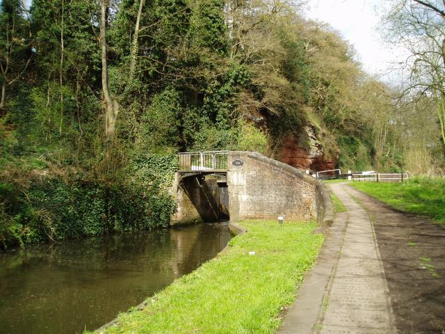
Image: © Martyn B Taken: 4 Apr 2005
Caldwall Lock has a split iron bridge to accommodate the rope in days of horse-drawn narrowboats. The sandstone cliff behind the lock is geologically interesting, being the southern tip of a bed of similar rock which stretches some 15 miles north. The picture was taken from grid reference SO 82765 75549.
Images are licensed for reuse under creativecommons.org/licenses/by-sa/2.0
Image Location


Leaflet Map data © OpenStreetMap
Latitude
52.377256
Longitude
-2.258498