A cairn on Teindside Hill
Introduction
The photograph on this page of A cairn on Teindside Hill by Walter Baxter as part of the Geograph project.
The Geograph project started in 2005 with the aim of publishing, organising and preserving representative images for every square kilometre of Great Britain, Ireland and the Isle of Man.

There are currently over 7.5m images from over 14,400 individuals and you can help contribute to the project by visiting https://www.geograph.org.uk
A cairn on Teindside Hill
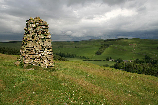
Image: © Walter Baxter Taken: 20 Jun 2009
This well built cairn is approximately 1.5x1.5m at the base, tapering up to a height of about 2m. There is an inscribed stone on the south face with the initials RE.RT, a date of 1880 and a carving of what appears to be an hourglass in the vertical position and the outline of a plough. It could be that a farmer from Northhouse Farm, which the cairn overlooks, was buried here in 1880. The cairn stands at the southern edge of a small hill fort, so it may be a dedication cairn rather than a marker for a burial place.
Images are licensed for reuse under creativecommons.org/licenses/by-sa/2.0
Image Location
Latitude
55.364493
Longitude
-2.898403