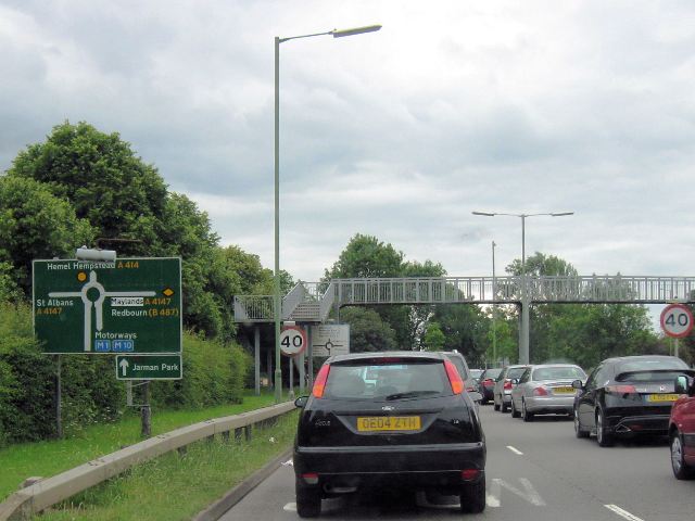
The Last Sign of the M10 Motorway?
Introduction
The photograph on this page of The Last Sign of the M10 Motorway? by Chris Reynolds as part of the Geograph project.
The Geograph project started in 2005 with the aim of publishing, organising and preserving representative images for every square kilometre of Great Britain, Ireland and the Isle of Man.
There are currently over 7.5m images from over 14,400 individuals and you can help contribute to the project by visiting https://www.geograph.org.uk

Image: © Chris Reynolds Taken: 19 Jun 2009
Over recent years work has been carried out to widen the M1 motorway north of Hemel Hempstead, and this has meant very significant changes to the M1/M10 junction. More than a year after the first of the changes have taken place at the junction the old road layout is still shown on online maps, while printed road maps will of course be out of date.. A few months ago the M10 motorway vanished. All the road signs pointing to it in the Hemel Hempstead and St Albans area had been altered to point to the non-motorway A414. I have seen no temporary signs on the approach roads to tell people that the road still exists, under a different name – despite the fact that online systems such as AA Route Finder still direct you to travel via the M10. People who do not know the area and are finding their way by instructions or maps must be having enormous trouble finding their way – while many who have used the M10 for years will perhaps be unaware that the “motorway” is now open for cyclists and horse riders. Yesterday I spotted this road sign – which has been overlooked by the planners who wanted to erase all references to the M10. Of course it will not help many people as it is only to be seen on the dual carriageway leading away from the former M10!

