May Craig
Introduction
The photograph on this page of May Craig by Anne Burgess as part of the Geograph project.
The Geograph project started in 2005 with the aim of publishing, organising and preserving representative images for every square kilometre of Great Britain, Ireland and the Isle of Man.

There are currently over 7.5m images from over 14,400 individuals and you can help contribute to the project by visiting https://www.geograph.org.uk
May Craig
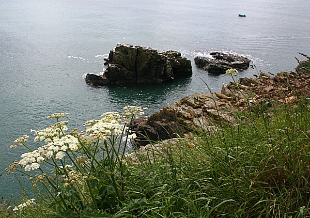
Image: © Anne Burgess Taken: 19 Jun 2009
Against the light from this angle, May Craig lies just offshore south of Newtonhill. Both rocks are popular with resting gulls, though I could not be sure at this range which species were present. The white umbellifers on the clifftop are Hogweed.
Images are licensed for reuse under creativecommons.org/licenses/by-sa/2.0
Image Location
Latitude
57.024971
Longitude
-2.146089