Rock outcrop near The Hermitage
Introduction
The photograph on this page of Rock outcrop near The Hermitage by Richard Law as part of the Geograph project.
The Geograph project started in 2005 with the aim of publishing, organising and preserving representative images for every square kilometre of Great Britain, Ireland and the Isle of Man.

There are currently over 7.5m images from over 14,400 individuals and you can help contribute to the project by visiting https://www.geograph.org.uk
Rock outcrop near The Hermitage
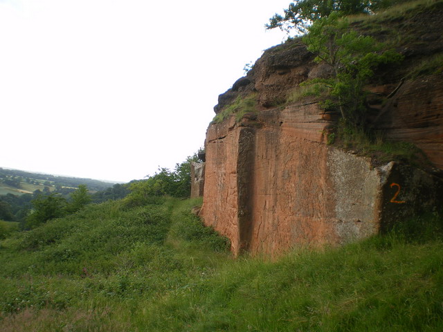
Image: © Richard Law Taken: 18 Jun 2009
A fuller view of one of the rock outcrops near the top of The Hermitage, showing the classic dune layering so typical of the sandstones in this area.
Images are licensed for reuse under creativecommons.org/licenses/by-sa/2.0
Image Location
Latitude
52.535526
Longitude
-2.402727