Lowesmoor Basin
Introduction
The photograph on this page of Lowesmoor Basin by Trevor Rickard as part of the Geograph project.
The Geograph project started in 2005 with the aim of publishing, organising and preserving representative images for every square kilometre of Great Britain, Ireland and the Isle of Man.

There are currently over 7.5m images from over 14,400 individuals and you can help contribute to the project by visiting https://www.geograph.org.uk
Lowesmoor Basin
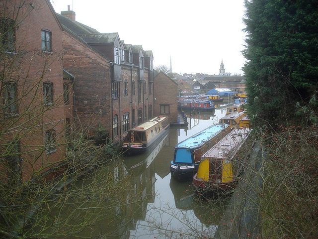
Image: © Trevor Rickard Taken: 28 Jan 2009
Looking west from the entrance bridge (see Image), with the railway embankment on the right. Built as a commercial wharf. Regenerated housing and canal boat services at this city-centre mooring since the 1970s, when it was completely derelict and unusable.
Images are licensed for reuse under creativecommons.org/licenses/by-sa/2.0
Image Location


Leaflet Map data © OpenStreetMap
Latitude
52.195554
Longitude
-2.218087