Bogle
Introduction
The photograph on this page of Bogle by Penny Mayes as part of the Geograph project.
The Geograph project started in 2005 with the aim of publishing, organising and preserving representative images for every square kilometre of Great Britain, Ireland and the Isle of Man.

There are currently over 7.5m images from over 14,400 individuals and you can help contribute to the project by visiting https://www.geograph.org.uk
Bogle
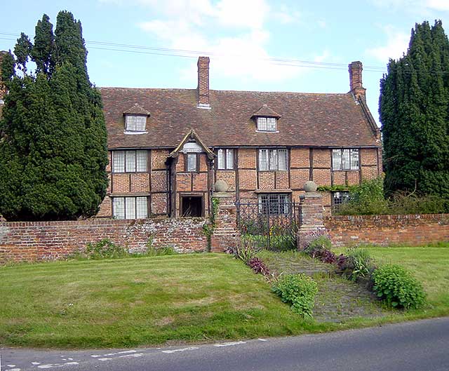
Image: © Penny Mayes Taken: 28 May 2005
Bogle is the name on the map but I have seen this Tudor/Jacobean house called "Beaugill" in an account published in 1926. The board on the gable above the porch reads "1643 H.W.I.I.", the letters apparently standing for Hugessen (the family name), William, John and James. The house dates from earlier but was purchased by the Hugessens in 1643 and enlarged by them. The house stands at the junction of Lynsted Lane with Bogle Road.
Images are licensed for reuse under creativecommons.org/licenses/by-sa/2.0
Image Location


Leaflet Map data © OpenStreetMap
Latitude
51.318555
Longitude
0.792941