Approaching Autherley Junction, near Wolverhampton
Introduction
The photograph on this page of Approaching Autherley Junction, near Wolverhampton by Roger D Kidd as part of the Geograph project.
The Geograph project started in 2005 with the aim of publishing, organising and preserving representative images for every square kilometre of Great Britain, Ireland and the Isle of Man.

There are currently over 7.5m images from over 14,400 individuals and you can help contribute to the project by visiting https://www.geograph.org.uk
Approaching Autherley Junction, near Wolverhampton
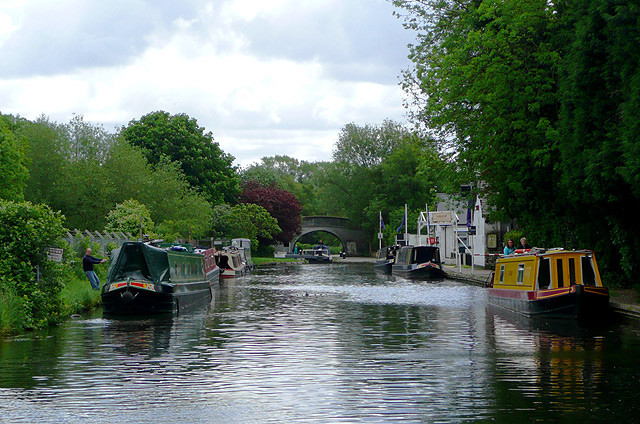
Image: © Roger D Kidd Taken: 26 May 2009
Narrowboats are for hire at the "marina" on the right. When not in use they are often moored four abreast on the left. Image] By the bridge in the distance, a narrowboat is in the stop-lock. This lock lowers the water by about six inches (15cm) and was insisted on by the older Staffordshire and Worcestershire Canal Company (beyond the bridge) to prevent the later Shropshire Union Canal (Birmingham and Liverpool Junction Canal as it was then) "stealing" the former's water.
Images are licensed for reuse under creativecommons.org/licenses/by-sa/2.0
Image Location
Latitude
52.616578
Longitude
-2.147803