Boiler house, Parsonage Colliery
Introduction
The photograph on this page of Boiler house, Parsonage Colliery by Chris Allen as part of the Geograph project.
The Geograph project started in 2005 with the aim of publishing, organising and preserving representative images for every square kilometre of Great Britain, Ireland and the Isle of Man.

There are currently over 7.5m images from over 14,400 individuals and you can help contribute to the project by visiting https://www.geograph.org.uk
Boiler house, Parsonage Colliery
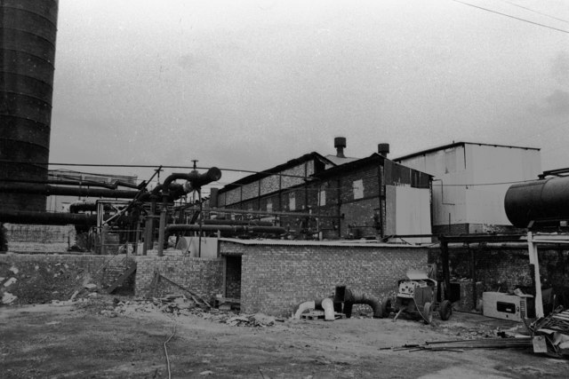
Image: © Chris Allen Taken: 7 Nov 1980
All long since gone. Only part of the boiler house is visibble and by this date the coal fired boilers were out of use and steam was being raised in a couple of boilers converted to burn oil. The oil was supplied by gravity from the tank seen at some elevation on the right hand edge of the photograph. This tank was a converted boiler obtained from another pit.
Images are licensed for reuse under creativecommons.org/licenses/by-sa/2.0
Image Location
Latitude
53.500031
Longitude
-2.527593