Castle Hill - information board
Introduction
The photograph on this page of Castle Hill - information board by Colin Vosper as part of the Geograph project.
The Geograph project started in 2005 with the aim of publishing, organising and preserving representative images for every square kilometre of Great Britain, Ireland and the Isle of Man.

There are currently over 7.5m images from over 14,400 individuals and you can help contribute to the project by visiting https://www.geograph.org.uk
Castle Hill - information board
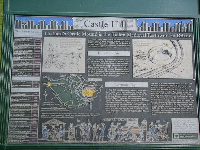
Image: © Colin Vosper Taken: 17 Apr 2009
This excellent information board in metal with raised lettering and diagrams for illustration explains that the earthworks are the work of two groups of people. The first group were the Iron Age people of 500 BC and many years later this same hill was used by the Normans in 1070 AD as the location of a Norman Castle. The information board contains a 'Thetford Time Line' starting at around 40 AD with the arrival of the Romans and continues through to the celebrations of 1999 when it was the 800th anniversary of the appointment of the town's first town mayor. It is an excellent and informative information board and one that is hard to vandalise.
Images are licensed for reuse under creativecommons.org/licenses/by-sa/2.0
Image Location
Latitude
52.412039
Longitude
0.755809