Poldhu Wells
Introduction
The photograph on this page of Poldhu Wells by Stanley Howe as part of the Geograph project.
The Geograph project started in 2005 with the aim of publishing, organising and preserving representative images for every square kilometre of Great Britain, Ireland and the Isle of Man.

There are currently over 7.5m images from over 14,400 individuals and you can help contribute to the project by visiting https://www.geograph.org.uk
Poldhu Wells
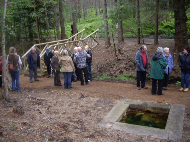
Image: © Stanley Howe Taken: 13 Jun 2009
The Lower Well and a rebuilt footbridge, on the occasion of the official opening to the public of the restored site on 13th June 2009. The wells had been all but lost beneath an invasion of rhododendron bushes until local volunteers laboured to uncover them.
Images are licensed for reuse under creativecommons.org/licenses/by-sa/2.0
Image Location
Latitude
57.120667
Longitude
-2.933233