Firbeck Main colliery
Introduction
The photograph on this page of Firbeck Main colliery by Ashley Dace as part of the Geograph project.
The Geograph project started in 2005 with the aim of publishing, organising and preserving representative images for every square kilometre of Great Britain, Ireland and the Isle of Man.

There are currently over 7.5m images from over 14,400 individuals and you can help contribute to the project by visiting https://www.geograph.org.uk
Firbeck Main colliery
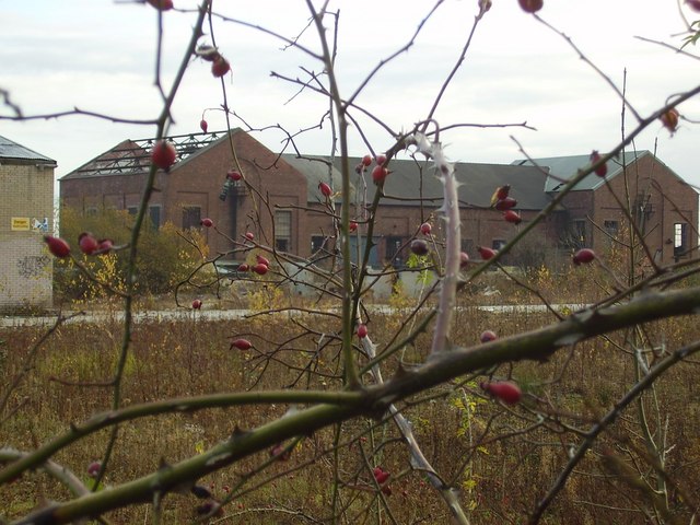
Image: © Ashley Dace Taken: Unknown
The colliery seen here is derelict and waiting for demolition or restoration (unlikely). The colliery had a short life compared to the others in the area (like Harworth) as there was geological problems (Faults I think). However its buildings survived them all (apart from Harworth which closed in 2006 and is mothballed)
Images are licensed for reuse under creativecommons.org/licenses/by-sa/2.0
Image Location
Latitude
53.368738
Longitude
-1.125278