Wimborne Minster: Turnpike Cottage
Introduction
The photograph on this page of Wimborne Minster: Turnpike Cottage by Chris Downer as part of the Geograph project.
The Geograph project started in 2005 with the aim of publishing, organising and preserving representative images for every square kilometre of Great Britain, Ireland and the Isle of Man.

There are currently over 7.5m images from over 14,400 individuals and you can help contribute to the project by visiting https://www.geograph.org.uk
Wimborne Minster: Turnpike Cottage
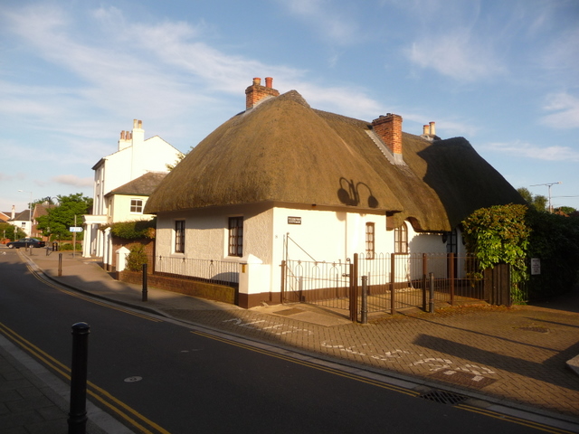
Image: © Chris Downer Taken: 10 Jun 2009
A picturesque cottage at the eastern end of East Street. Its location at the edge of the old town, its name and the fact that it protrudes into the carriageway compared to its neighbour, all suggest that it may once have been a tollgate cottage.
Images are licensed for reuse under creativecommons.org/licenses/by-sa/2.0
Image Location
Latitude
50.797851
Longitude
-1.983347