?ird Uig
Introduction
The photograph on this page of ?ird Uig by Anne Burgess as part of the Geograph project.
The Geograph project started in 2005 with the aim of publishing, organising and preserving representative images for every square kilometre of Great Britain, Ireland and the Isle of Man.

There are currently over 7.5m images from over 14,400 individuals and you can help contribute to the project by visiting https://www.geograph.org.uk
?ird Uig
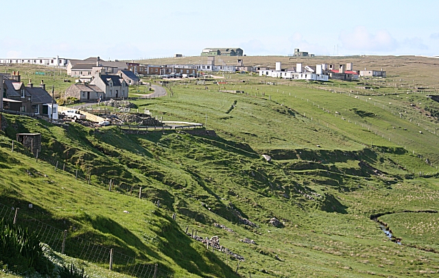
Image: © Anne Burgess Taken: 4 Jun 2009
My reaction to seeing Àird Uig for the first time was dismay. In the interests of national security Gallan Head has been completely fenced off and the landscape disfigured by the construction of ugly military style buildings, many of which are now decaying. However some of the buildings have been taken over and are kept in good repair and in use for housing and a hotel.
Images are licensed for reuse under creativecommons.org/licenses/by-sa/2.0
Image Location


Leaflet Map data © OpenStreetMap
Latitude
58.232668
Longitude
-7.029346