Weston-super-Mare: Worlebury hillfort
Introduction
The photograph on this page of Weston-super-Mare: Worlebury hillfort by Martin Bodman as part of the Geograph project.
The Geograph project started in 2005 with the aim of publishing, organising and preserving representative images for every square kilometre of Great Britain, Ireland and the Isle of Man.

There are currently over 7.5m images from over 14,400 individuals and you can help contribute to the project by visiting https://www.geograph.org.uk
Weston-super-Mare: Worlebury hillfort
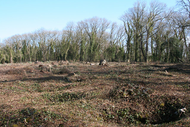
Image: © Martin Bodman Taken: 9 Mar 2006
Recent tree clearance of part of the 10-acre site, in the hands of North Somerset Council, has revealed some of the 93 storage pits first discovered in the 1850s, when the site was excavated by a group of antiquarians. Grain was found in a number of the pits, which are unusually large at 6 to 8 feet in diameter and typically 6 feet deep
Images are licensed for reuse under creativecommons.org/licenses/by-sa/2.0
Image Location
Latitude
51.3565
Longitude
-2.988005