Old road signs on the B6265, Threshfield
Introduction
The photograph on this page of Old road signs on the B6265, Threshfield by Humphrey Bolton as part of the Geograph project.
The Geograph project started in 2005 with the aim of publishing, organising and preserving representative images for every square kilometre of Great Britain, Ireland and the Isle of Man.

There are currently over 7.5m images from over 14,400 individuals and you can help contribute to the project by visiting https://www.geograph.org.uk
Old road signs on the B6265, Threshfield
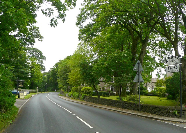
Image: © Humphrey Bolton Taken: 7 Jun 2009
The chequer over B6160 means 'leading to. The two 'B' roads cross 200m ahead, and the left turn on the B6120 goes to Kettlewell. On the left the sign for the Old Hall Inn, a pub-restaurant, can be seen.
Images are licensed for reuse under creativecommons.org/licenses/by-sa/2.0
Image Location
Latitude
54.067437
Longitude
-2.0183