Canal beneath Snow Hill Viaduct
Introduction
The photograph on this page of Canal beneath Snow Hill Viaduct by Row17 as part of the Geograph project.
The Geograph project started in 2005 with the aim of publishing, organising and preserving representative images for every square kilometre of Great Britain, Ireland and the Isle of Man.

There are currently over 7.5m images from over 14,400 individuals and you can help contribute to the project by visiting https://www.geograph.org.uk
Canal beneath Snow Hill Viaduct
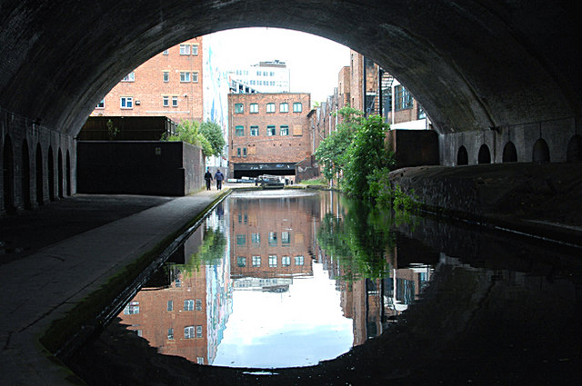
Image: © Row17 Taken: 8 Jun 2009
The viaduct carries the old GWR line from Birmingham Snow Hill (the 'old' Snow Hill Station was, in my view, far superior to the new one) to Wolverhampton Low Level (and I won't get on that 'soap-box'). The metro station called St. Pauls is now above the canal.
Images are licensed for reuse under creativecommons.org/licenses/by-sa/2.0
Image Location
Latitude
52.485738
Longitude
-1.901734