2009 : View north to Bristol
Introduction
The photograph on this page of 2009 : View north to Bristol by Maurice Pullin as part of the Geograph project.
The Geograph project started in 2005 with the aim of publishing, organising and preserving representative images for every square kilometre of Great Britain, Ireland and the Isle of Man.

There are currently over 7.5m images from over 14,400 individuals and you can help contribute to the project by visiting https://www.geograph.org.uk
2009 : View north to Bristol
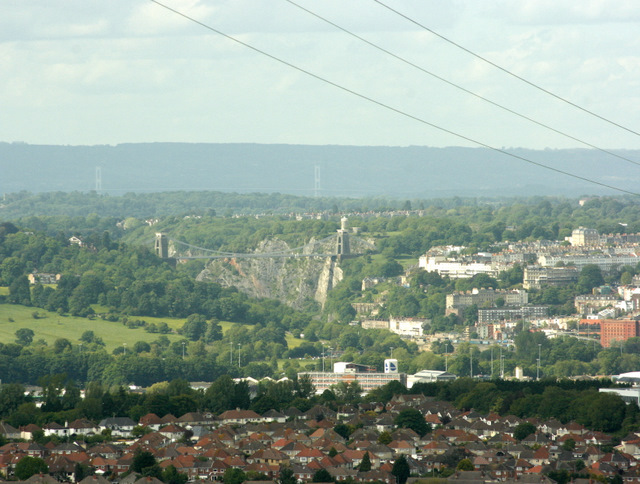
Image: © Maurice Pullin Taken: 26 May 2009
From East Dundry Lane near Dundry. Brunel's Clifton Suspension Bridge figures Image The Aust to Beachley Severn Road Bridge Image is faint in the distance. One of the red brick customs houses by Bristol docks is to the right, the entrance lock to the docks can almost be seen to the left of it. Look at the right hand tower of the Clifton Bridge, the round building which appears to sit on top is the Observatory and camera obscura (wonder if it still works). In fact it stands some 200 yards beyond. Ashton Court Estate is to the left, now public parkland. Apologies for the power lines across the top of the picture, could remove them but refuse to pander to the Electricity Company, they should do it.
Images are licensed for reuse under creativecommons.org/licenses/by-sa/2.0
Image Location
Latitude
51.398118
Longitude
-2.624222