Virginia Park
Introduction
The photograph on this page of Virginia Park by Martyn Davies as part of the Geograph project.
The Geograph project started in 2005 with the aim of publishing, organising and preserving representative images for every square kilometre of Great Britain, Ireland and the Isle of Man.

There are currently over 7.5m images from over 14,400 individuals and you can help contribute to the project by visiting https://www.geograph.org.uk
Virginia Park
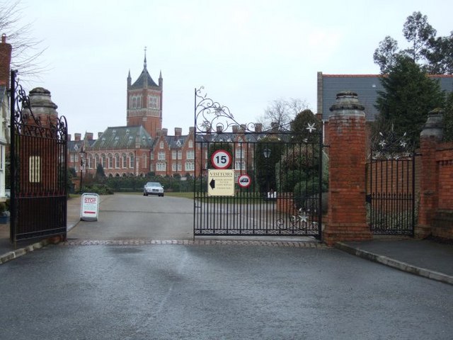
Image: © Martyn Davies Taken: 9 Mar 2006
This grand Victorian building was the Holloway Sanatorium, but it closed in 1981. After a period of neglect and disrepair, it was converted into a large private housing estate in about 1996.
Images are licensed for reuse under creativecommons.org/licenses/by-sa/2.0
Image Location
Latitude
51.404155
Longitude
-0.559872