Hewitts Farm
Introduction
The photograph on this page of Hewitts Farm by Ian Capper as part of the Geograph project.
The Geograph project started in 2005 with the aim of publishing, organising and preserving representative images for every square kilometre of Great Britain, Ireland and the Isle of Man.

There are currently over 7.5m images from over 14,400 individuals and you can help contribute to the project by visiting https://www.geograph.org.uk
Hewitts Farm
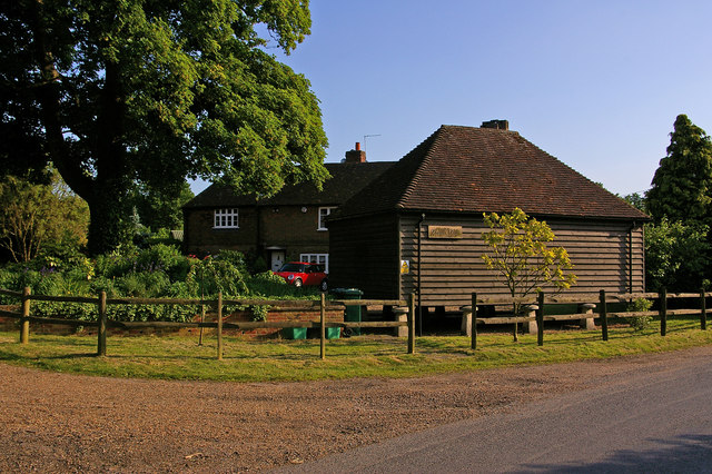
Image: © Ian Capper Taken: 1 Jun 2009
Although Hewitts Farm is normally thought of as referring to the "pick your own" centre on the A224 (see Image), the farmhouse itself is on nearby Hewitts Lane. The main building dates from the 18th century and is grade II listed (for listing particulars see www.historicengland.org.uk/listing/the-list/list-entry/1054719). Note the barn on staddle stones, to protect from vermin.
Images are licensed for reuse under creativecommons.org/licenses/by-sa/2.0
Image Location


Leaflet Map data © OpenStreetMap
Latitude
51.349659
Longitude
0.137504