Unloading quay
Introduction
The photograph on this page of Unloading quay by Alan Murray-Rust as part of the Geograph project.
The Geograph project started in 2005 with the aim of publishing, organising and preserving representative images for every square kilometre of Great Britain, Ireland and the Isle of Man.

There are currently over 7.5m images from over 14,400 individuals and you can help contribute to the project by visiting https://www.geograph.org.uk
Unloading quay
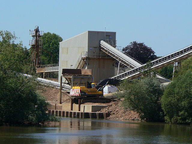
Image: © Alan Murray-Rust Taken: 1 Jun 2009
Attenborough Quarry is possibly unique in still retaining barge traffic to bring the raw aggregates from the quarry site to the processing plant. This clearly made sense when the extraction grounds were relatively close, and the method has been retained even though the loading point is over 4 kilometres distant. This is the unloading quay near Attenborough village.
Images are licensed for reuse under creativecommons.org/licenses/by-sa/2.0
Image Location
Latitude
52.909357
Longitude
-1.224371