Rough pasture behind Chapel Croft, Rastrick
Introduction
The photograph on this page of Rough pasture behind Chapel Croft, Rastrick by Humphrey Bolton as part of the Geograph project.
The Geograph project started in 2005 with the aim of publishing, organising and preserving representative images for every square kilometre of Great Britain, Ireland and the Isle of Man.

There are currently over 7.5m images from over 14,400 individuals and you can help contribute to the project by visiting https://www.geograph.org.uk
Rough pasture behind Chapel Croft, Rastrick
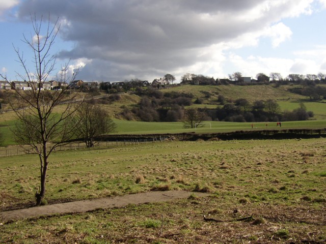
Image: © Humphrey Bolton Taken: 2 Mar 2006
This is a former stone mine, but the strip of concrete was used for cricket practice by the boys of Rastrick Grammar School, Ogden Lane. Nets were erected round the strip for batting and bowling practice, the entire field being used for sports by the school at that time until the school's amalgamation with Reinswood School to form Rastrick High in approx. 1983. Most of the mined area has been turned into the playing fields in the middle distance, and Toothill is at the top of the far hillside.
Images are licensed for reuse under creativecommons.org/licenses/by-sa/2.0
Image Location


Leaflet Map data © OpenStreetMap
Latitude
53.68797
Longitude
-1.791